|
 Boundary Waters Quetico ForumGear ForumGarmin BWCA map
|
 Forum Sponsor

Author
Text
")


12/04/2019 09:43AM
I don’t have the Garmin one, but I wanted to post to recommend the one I’ve got that works for Garmin devices. It’s PaddleNav by Red Pine Mapping. They sell them at Piragis in Ely. It’s got portages marked with distance, lake names, campsites, fish species found in each lake, etc. I have yet to find an error on this map and I’ve had it for two years now. It costs around $70.
Tony
Tony
Tony
")

12/04/2019 11:11AM
Nice thing with the RedPine map is it's not locked to a specific GPS and is transferable, you are limited to 5 personal use copies I think. Accuracy depends on updates and both are older maps and info. I have found errors on RedPine in Quetico but very few.
There is posted in the GPX forum a link to camp and portage waypoints along with other .gpx files, for use with the onboard maps and such.
butthead
There is posted in the GPX forum a link to camp and portage waypoints along with other .gpx files, for use with the onboard maps and such.
butthead
"never underestimate the power of stupid people in large groups" George Carlin
12/04/2019 11:39AM
brdhntr: "On our trip in July, I had the handheld from my Garmin Alpha with me just in case. It is loaded with the base Garmin Topo map and it had all the campsites on it. "
That's interesting that the base topo map had the campsites. I just ordered the In Reach Garmin GPS. I assume that the base map you are referring to is the 24K one that is pre-loaded on the device?
12/04/2019 11:41AM
butthead: "Nice thing with the RedPine map is it's not locked to a specific GPS and is transferable, you are limited to 5 personal use copies I think. Accuracy depends on updates and both are older maps and info. I have found errors on RedPine in Quetico but very few.
There is posted in the GPX forum a link to camp and portage waypoints along with other .gpx files, for use with the onboard maps and such.
butthead"
Thanks for the heads up on the GPX forum
12/04/2019 12:32PM
There also exists a transparent map that you can load onto your GPS that has all the campsites and portages marked on it, so you don't need to give up precious waypoint space for those things. The map can be stacked on top of a topographic or other map. It's pretty neat. I plan on using that in conjunction with USGS quads I downloaded via BirdsEye imagery. Probably the best $30 "accessory" I've bought for my GPS so far. It basically turns the display into a McKenzie map, they use USGS quads for their printed maps products.
When a man is part of his canoe, he is part of all that canoes have ever known. - Sigurd F. Olson, "The Singing Wilderness"
12/04/2019 01:23PM
mirth: "There also exists a transparent map that you can load onto your GPS that has all the campsites and portages marked on it, so you don't need to give up precious waypoint space for those things. The map can be stacked on top of a topographic or other map. It's pretty neat. I plan on using that in conjunction with USGS quads I downloaded via BirdsEye imagery. Probably the best $30 "accessory" I've bought for my GPS so far. It basically turns the display into a McKenzie map, they use USGS quads for their printed maps products."
Where did you buy it?
12/04/2019 09:22PM
I use the Garmin Inland Lakes Boundary Waters chip in my 62S unit and it works excellent, showing the portages and campsites just fine in both the BWCAW and Quetico. It shows lake topo info in the BWCAW, but topo isn't available for the Q from anywhere as far as I'm aware.
Endeavor to persevere.
12/05/2019 08:26AM
Redpine topo lines are not accurate unless the creeks do run up and down the hills and the lakes are higher on one end than the other. I do like not having the map stop at the border like many other maps. I would prefer not having the campsites on the map letting me use the one I download from PP.
The question of the day is Freedom or Socialism?? MagicPaddler
12/05/2019 10:32AM
There is a good solution and fairly inexpensive. Combining Garmin Birdseye Topo Raste USGS maps with GPS File Depot BWCA Quetico map files. This is described in the GPS forum.

 USGS and Canadian NRC maps on Basecamp.

Seagull screenshot 62st
butthead

 USGS and Canadian NRC maps on Basecamp.
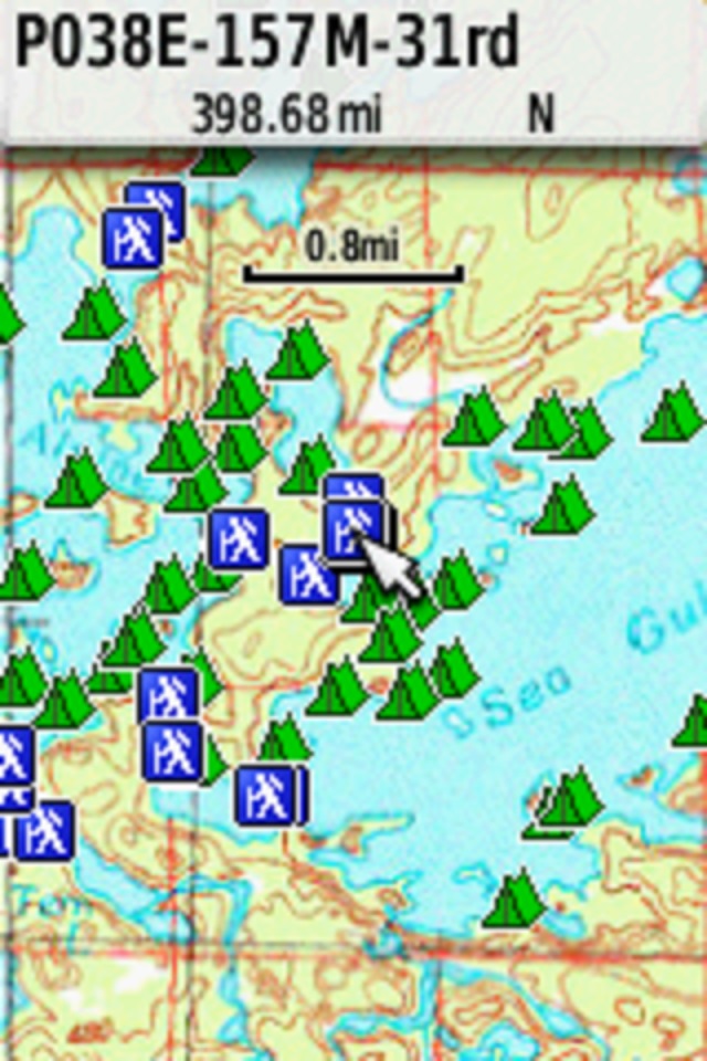
Seagull screenshot 62st
butthead
"never underestimate the power of stupid people in large groups" George Carlin
12/05/2019 11:04AM
butthead: "There is a good solution and fairly inexpensive. Combining Garmin Birdseye Topo Raste USGS maps with GPS File Depot BWCA Quetico map files. This is described in the GPS forum.
Seagull screenshot 62st
butthead"
Yup, that's what I use & who I learned it from. You can buy a 1 year access from Garmin and download as much as you want during that year. After the 12 months are up you can keep what you downloaded. I've already grabbed most of the 3 state area I haunt most often, plus other places I know I'll be back to out West like Philmont. You need a compatible Garmin GPS (most, if not all modern units with screens) hooked up to activate the subscription and download map data. Once you have it downloaded you can install it on whatever device you want and can view it in Basecamp w/o the GPS attached.
When a man is part of his canoe, he is part of all that canoes have ever known. - Sigurd F. Olson, "The Singing Wilderness"
12/06/2019 05:32AM
Yup, that's what I use & who I learned it from. You can buy a 1 year access from Garmin and download as much as you want during that year. After the 12 months are up you can keep what you downloaded. I've already grabbed most of the 3 state area I haunt most often, plus other places I know I'll be back to out West like Philmont. You need a compatible Garmin GPS (most, if not all modern units with screens) hooked up to activate the subscription and download map data. Once you have it downloaded you can install it on whatever device you want and can view it in Basecamp w/o the GPS attached."
Is it $30 for a year?
12/06/2019 11:20AM
EricaL: "
Yup, that's what I use & who I learned it from. You can buy a 1 year access from Garmin and download as much as you want during that year. After the 12 months are up you can keep what you downloaded. I've already grabbed most of the 3 state area I haunt most often, plus other places I know I'll be back to out West like Philmont. You need a compatible Garmin GPS (most, if not all modern units with screens) hooked up to activate the subscription and download map data. Once you have it downloaded you can install it on whatever device you want and can view it in Basecamp w/o the GPS attached."
Is it $30 for a year?"
Yes. And after the year you simply lose the ability to download additional imagery. Be advised you should create backups of your Basecamp data occasionally and save it to an external hard drive or flash drive. After adding large swaths of MN, WI, IL, MI, and NM my backup file jumped up from 40MB to 15GB in size. If you lose the Basecamp data file you lose the downloaded imagery.
When a man is part of his canoe, he is part of all that canoes have ever known. - Sigurd F. Olson, "The Singing Wilderness"
12/15/2019 11:10AM
Question in regards to the Redpine maps. Looking on their website everything I see says you have to install it via sd card or via mapinstall/basecamp. The Inreach explorer + i just bought evidently can only be used with the Garmin online map/sync software and does not work with the mapinstall/basecamp software. Anyone else experince this and if so how do I load the Redpine maps on my Inreach?
12/15/2019 01:37PM
No simple work around with the Inreach Explorer as this uses online mapping application. You'd need to extract .gpx files from the RedPine Map and transfer those file to the Inreach app.
RedPine Maps will work with Garmin GPS handheld units that support Basecamp and MapQuest. 62/64/66 and others.
Inreach Explorer is primarily a communication device with limited GPS functions.
butthead
RedPine Maps will work with Garmin GPS handheld units that support Basecamp and MapQuest. 62/64/66 and others.
Inreach Explorer is primarily a communication device with limited GPS functions.
butthead
"never underestimate the power of stupid people in large groups" George Carlin
12/15/2019 07:58PM
butthead: "fadersup: Where did you buy it?"
Not sure about purchasing but one is available, GPS File Depot free.
butthead"
It bears noting that the campsite info in that file is apparently from August 2009. That predates the Pagami Creek Fire, which resulted in the (so far) permanent closure of quite a few sites.
12/25/2019 08:52PM
singlebladecanoe: "Question in regards to the Redpine maps. Looking on their website everything I see says you have to install it via sd card or via mapinstall/basecamp. The Inreach explorer + i just bought evidently can only be used with the Garmin online map/sync software and does not work with the mapinstall/basecamp software.
Butthead nailed it when he said the InReach has limited GPS functionality. HOWEVER, you CAN download a .gpx file to the InReach. I like to use PP to plan out my routes, and the .gpx file you get from the website can be loaded onto the InReach. It has the route and all the campsites on it. I think you need to remove the campsites that are not in the area you are going to, because there are too many for the InReach to handle.
I use the Garmin BWCA map on my trips to Quetico, the microSd card installed in my Garmin 78. I also put the .gpx from PP on it. That is good redundant information, and lots of times you can see that the PP data is better than the Garmin data.
I have the InReach for two-way texting capability and don't use the gps functions. the battery life is limited if you leave it on for navigation purposes, and it has internal rechargeable batteries. I wish I had bought a 66i or 86i instead, these are true powerful GPS units with the two way communications also, a true all-in-one unit. If I had a 66i or 86i, then I would leave the 78 at home and bring a solar panel or power pack to recharge the GPS.
Joe
04/04/2024 10:23PM
butthead: "You can purchase Red Pine BWCA Quetico maps online for $55.
butthead"
Bumping an old thread. I just purchased a Garmin watch and want to get setup with GPS on it for my trip in June. The red pine maps seem to have glowing reviews however I’m wondering if they went out of business? Their website doesn’t load and the links in the thread are broken.
If redpine is gone wondering what the best recommendation would be. If it’s relevant I got a Garmin Epix 2
Thank you
04/05/2024 07:30AM
JLand: "butthead: "You can purchase Red Pine BWCA Quetico maps online for $55.
butthead"
Bumping an old thread. I just purchased a Garmin watch and want to get setup with GPS on it for my trip in June. The red pine maps seem to have glowing reviews however I’m wondering if they went out of business? Their website doesn’t load and the links in the thread are broken.
If redpine is gone wondering what the best recommendation would be. If it’s relevant I got a Garmin Epix 2
Thank you"
RedPine was great with PaddleNav but you are correct they must of gone out of business. I had their app on my iPad and iPhone and it is no longer supported, probably for 3-4 years?
T
04/11/2024 10:48AM
timatkn: "JLand: "butthead: "You can purchase Red Pine BWCA Quetico maps online for $55.
butthead"
Bumping an old thread. I just purchased a Garmin watch and want to get setup with GPS on it for my trip in June. The red pine maps seem to have glowing reviews however I’m wondering if they went out of business? Their website doesn’t load and the links in the thread are broken.
If redpine is gone wondering what the best recommendation would be. If it’s relevant I got a Garmin Epix 2
Thank you"
RedPine was great with PaddleNav but you are correct they must of gone out of business. I had their app on my iPad and iPhone and it is no longer supported, probably for 3-4 years?
T"
Any recommendation for me then?
04/13/2024 10:15AM
I have the Garmin Fenix 6 watch and I like it for a quick look while paddling. I think you will need your phone on for this to work, airplane mode.
If you want BWCA mapping for a GPS unit I would suggest you get one of the 2 Garmin chips or downloads. There is a BWCA chip and a USGS 24000 topo chip from Garmin that will cover anyone’s needs.
If you want BWCA mapping for a GPS unit I would suggest you get one of the 2 Garmin chips or downloads. There is a BWCA chip and a USGS 24000 topo chip from Garmin that will cover anyone’s needs.
"So many lakes, so little time." WWJD
04/17/2024 07:55AM
Boonequest: "I personally didn’t find the maps and navigation on my watch that helpful. I have the Fenix 7 watch. I found that using OnX Hunt on my cell phone worked best. Of course you will need a subscription for that app if you do that. "
Never considered something like this for my Fenix 6 but I could see where it could come in handy. Could you expand on why you didn't like it?
$99 is kind of a shock. I suppose that's still less than a full set of paper maps but it wouldn't fully replace paper maps for me to begin with.
Garmin TOPO BWCA
04/17/2024 09:05AM
Search for the Upper Midwest Fishing Guide chip on 3rd party seller sites. Multiple listings on eBay right now for around $50. It has the bathymetric mapping for nearly all BW lakes, LOW, Rainy, and many more over multiple states and across the border for some distance into Canada.
"You can observe a lot just by watching." -- Yogi Berra
04/17/2024 09:12PM
plmn: "Boonequest: "I personally didn’t find the maps and navigation on my watch that helpful. I have the Fenix 7 watch. I found that using OnX Hunt on my cell phone worked best. Of course you will need a subscription for that app if you do that. "
Never considered something like this for my Fenix 6 but I could see where it could come in handy. Could you expand on why you didn't like it?
$99 is kind of a shock. I suppose that's still less than a full set of paper maps but it wouldn't fully replace paper maps for me to begin with.
Garmin TOPO BWCA
"
I guess it was just too small and I was not confident that I was able to get a good bearing of where o was headed. Compared to OnX on my phone, it just didn’t have the detail to give me confidence in what I was seeing. Maybe I didn’t give it a good enough shot because I had my phone but it definitely wasn’t as nice as OnX. I do think you can subscribe to a single state for something like $30. $99 gives you the entire US. I get that because I hunt multiple states but I’m not sure I would pay that for the two BWCA trips I go on each year.
04/19/2024 11:06AM
Boonequest: "I guess it was just too small and I was not confident that I was able to get a good bearing of where o was headed. Compared to OnX on my phone, it just didn’t have the detail to give me confidence in what I was seeing. Maybe I didn’t give it a good enough shot because I had my phone but it definitely wasn’t as nice as OnX. I do think you can subscribe to a single state for something like $30. $99 gives you the entire US. I get that because I hunt multiple states but I’m not sure I would pay that for the two BWCA trips I go on each year. "
Thanks, I can't find any reviews or demonstrations of the BWCA maps on a watch. Right now the price is too high and my need for it too low to try it.
Subscribe to Thread
Become a member of the bwca.com community to subscribe to thread and get email updates when new posts are added. Sign up Here
Community Links
 Search BWCA.com
 Donate
 Featured Sponsor
